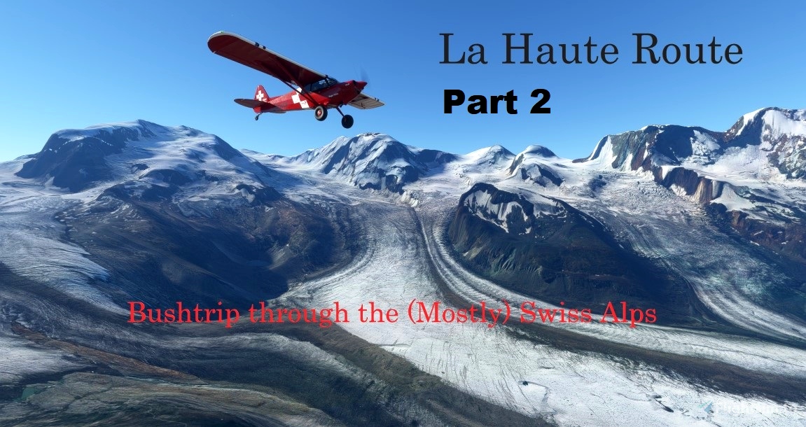
La Haute Route (trans: The High Road) is a rough trail between Chamonix, France and Zermatt, Switzerland. Made on foot and skis over alpine ridges and glaciers since the 1800s, it usually takes between one and two weeks to travel. This Bushtrip is inspired by this trail, and extends it. Part 1 of this journey can be found below.
La Haute Route - Alpine Bushtrip
Current Version 1.0 by Dready1906
https://flightsim.to/file/4927/la-haute-route-alpine-bushtrip
I strongly suggest you complete that bushtrip first. Some of you told me that the considered Part 1 to be 'Advanced'. Part 2 will push the envelope even more. 'Expert' level? You tell me. I would appreciate the comments.
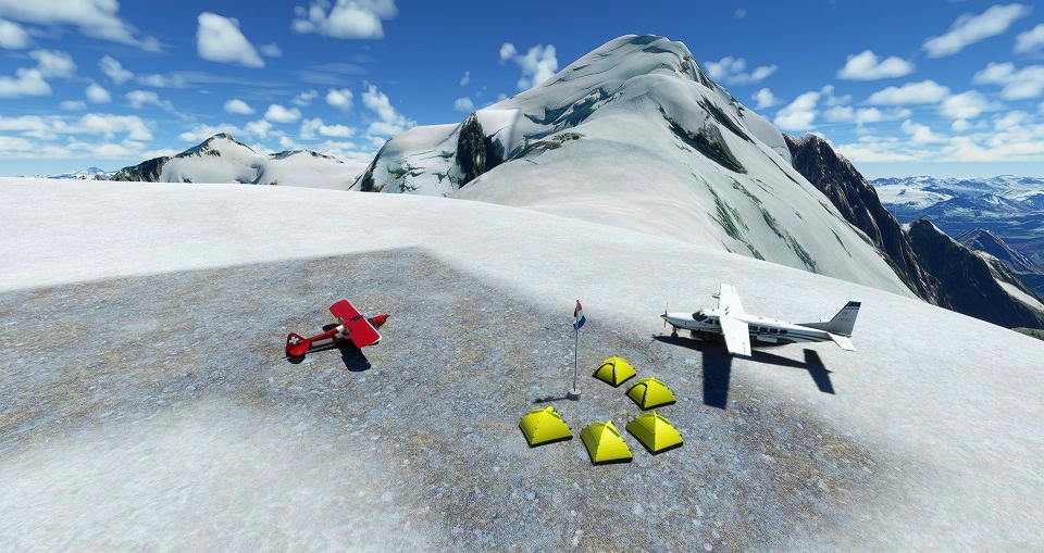
Part 1 started from the French town of Sallanches near Chamonix, and cut a path through Valais (Wallis) to Zermatt, into Italy and up to central Switzerland. through the Grisons (Graubunden) regions. In Part 2 we will come full circle, leaving Lake Lucerne where Part 1 finished, going through the Bernese Oberland before visiting Gstaad and Gruyeres, and then back to the Mont-Blanc region where we will end the trip literally at the top of Europe - the Altisurface Du Glacier Du Dome Du Gouter, at 14,000 feet, basically a short walk away from the summit of Mont-Blanc.
Created using :BushTripInjector
Current Version 0.3.10.531 by BuffyGC
https://flightsim.to/file/4131/bushtripinjector
Many thanks to BuffyGC for an excellent tool which he is continuously working to improve.
INSTALLATION:
================
Simply unzip the file, and copy the resulting folder and contents into the Community folder.
REQUIRED ADD-ONS:
==================
Two mods are required.
Alps altiports
As the final stop is not an airstrip currently in FS2020 by default. This very cool mod adds this and several more high-altitude airstrips thoughout the French Alps.
Current Version 1.1.0 by bagolu
https://flightsim.to/file/3652/alps-altisurface
X-Cub Rega Swiss Air Rescue
This bushtrip uses the very nice livery of REGA, the Swiss air rescue and air ambulance service
Current Version 1.1 by ANN0V
https://flightsim.to/file/4481/x-cub-rega
SUGGESTED ADD-ONS:
==================
All of these are optional, strictly speaking, but do enhance the experience.
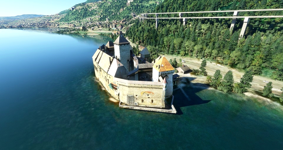
1) Château de Chillon Scenery
Current Version 1.0 by Gobby
https://flightsim.to/file/2879/chateau-de-chillon-scenery
2) Château de Blonay
Current Version 1.0 by legofun1974
https://flightsim.to/file/2940/chateau-de-blonay
3) We Love VFR - Region 1
Current Version 0.3.0b by PuffinFlight
https://flightsim.to/file/2605/we-love-vfr-region-1
4) ItalyDEM
In spite of the name, this mod updates the digital elevation data for all of Switzerland, making the terrain more realistic - not perfect but a definite upgrade over a lot of the lo-res data currently in the sim. The Eiger, Monch and Jungfrau are now actually recognizable :-)
Current Version 1.0 by sprightlyoldman
https://flightsim.to/file/5552/italydem
5) Swiss Airfields
Current Version 0.14 by Swiss Airfield Crafters
https://flightsim.to/file/2798/swiss-airfields
IMPORTANT NOTES:
================
1) There are numerous climbs to high altitude on this trip. FS2020 disables the Automixture feature in Bushtrips so you will have to manage the Fuel Mixture yourself. There is also a 'Best Mixture' function, under Options/Controls/, which I mapped to my 'm' key on the keyboard - just remember to tap it every time you change altitude more than 1000 feet or so. If you find yourself unable to reach altitude for a certain pass, I have tried to ensure you have room to circle and keep climbing before resuming your route.
2) The Navlog instructions are detailed with pictures, sometimes with routes marked with arrows, and hints as to when you should start climbing, as sometimes steep elevation changes will creep up on you. I strongly suggest you Read through the entire Navlog at spawn, and then use the Active Pause feature (key it to the Pause button on your keyboard) to periodically stop and check the entries on the next few waypoints. This is also a good time to check out the scenery.
3) The GPS course is loaded into the X-Cub's navigation system, so you can look at the course indicator on the PFD if you are confused by the Navlog instructions. If you don't want to see these 'hints' you can change the CDI source to NAV1 or 2 and you won't see them. The autopilot NAV mode works as well, but I would not recommend that because some of the waypoints show a straight line when actually you have to dodge a few mountains in the way. There are a couple of places where use of the GPS CDI is recommended for special challanges - they will be mentioned in the Navlog.
4) When starting a new leg, you will spawn where you ended the previous leg. On this bushtrip, this may be uphill on a steeply sloped airstrip, headed the wrong way for takeoff. So when spawning, immediately make sure your brakes are on, and check if you need to taxi to a proper takeoff position.
5) While the total distance is not great, and estimated completion time (calculated by FS2020 as the distance at the X-Cub's maximum cruise speed) is only around 2 hours, in reality it will take you quite a bit longer, because of all the altitude changes (BTW best climb speed in the X-Cub is 55-60 knots, 65 knots if you have to make turns).
LEGS
=====
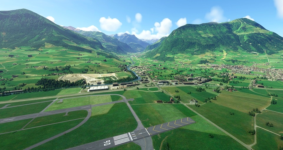
1) Buochs (LSZC) to Meiringen Mil (LSMM) - via Engelberg and behind the Titlis
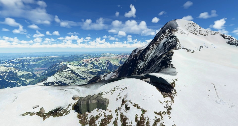
2) Meiringen Mil (LSMM) to Interlaken Mil (LSMI) - Overflight of the Konkordiaplatz glaciers and the Jungfraujoch.
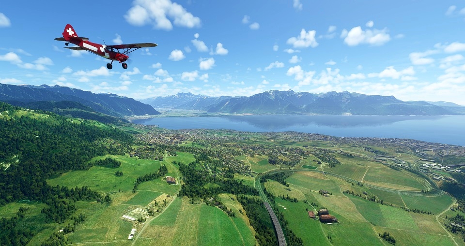
3) Interlaken Mil (LSMI) to Saanen (LSGK) - via Adelboden and Gstaad
4) Saanen (LSGK) to Gruyeres (LSGT) - a short leg with a landing challenge.
5) Gruyeres (LSGT) to Altisurface Du Glacier Du Dome Du Gouter (7424) - Top of the world, Ma!
A PERSONAL NOTE
================
I grew up in Switzerland and I am quite familiar with all the locations on this Bushtrip (although not by air). Some of the places visited on this bushtrips are tragically poorly rendered in FS2020, such as the astonishingly beautiful Lauterbrunnen Valley, or the village and castle at Gruyeres which now looks like a bunch of warehouses, or the Palace Hotel in Gstaad that looks like... well you get the idea. I will keep an eye out for future updates or mods that will improve the experience and attach them in the text.


Merci et bravo! Superbe voyage à travers les Alpes, superbe avec les Add-ons recommandés!
3 years ago
Ceclo
Thanks a lot for this, a great experience in VR with the Reverb G2
3 years ago
3 years ago
Dready1906
neolec2001
3 years ago
Dready1906
3 years ago
3 years ago
Dready1906
Piper9t3
3 years ago
3 years ago
Dready1906
BostonJeremy77