Ardèche (07) FRANCE
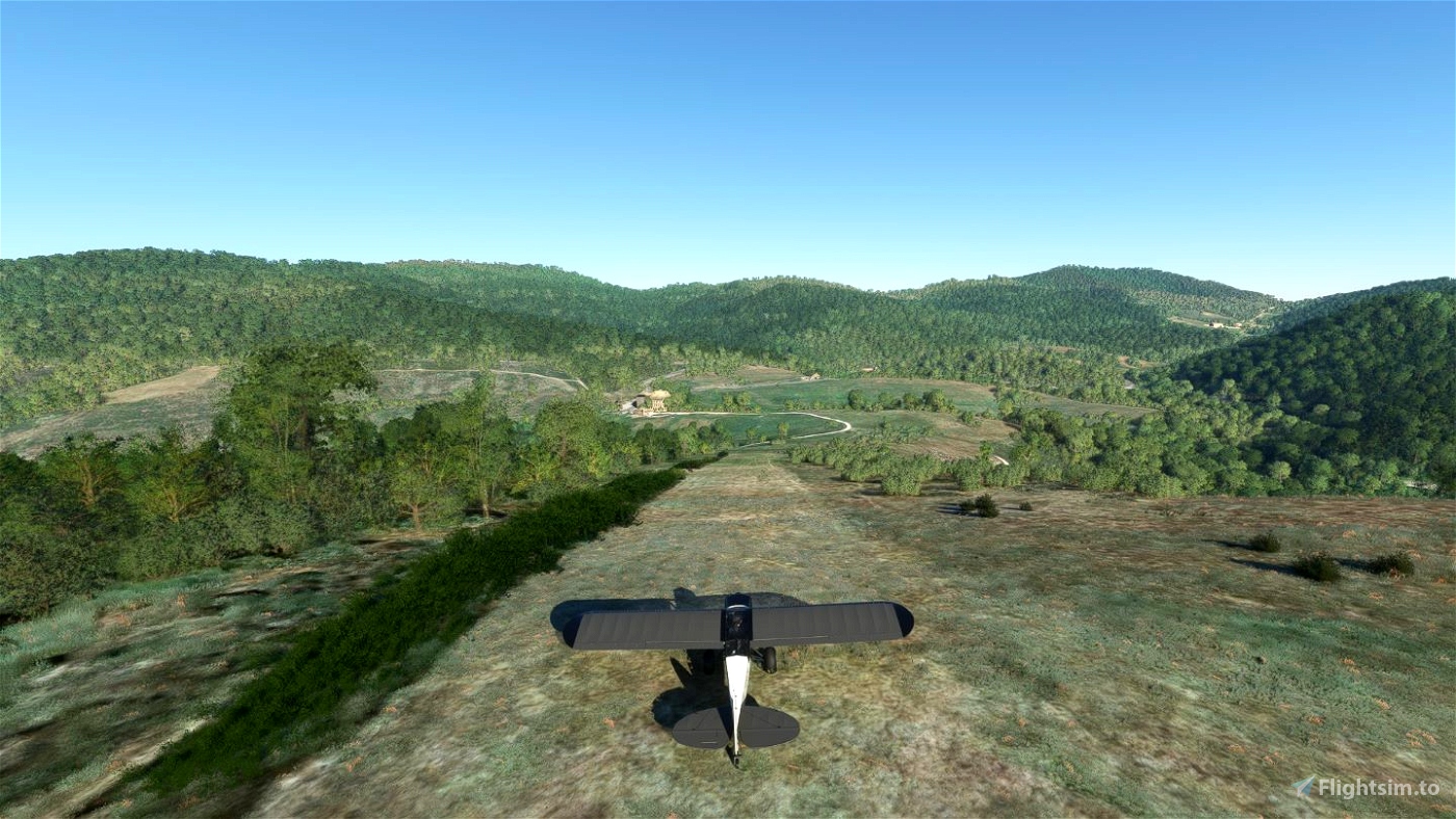
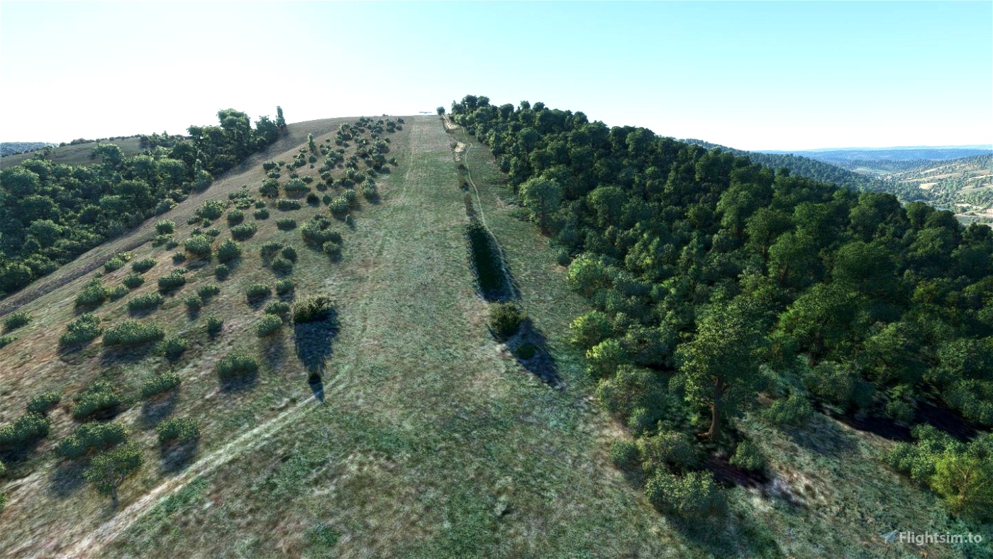
Une chouette petite piste bien pentue dans la montagne ardèchoise sur la commune de Thueyts.
ICAO dans MSFS: F0725 (remplace LF03 Aéroport de Thueyts générique)
LAT : N 44 38 01 - LONG :E 004 02 46 - ALT : 4320 ft
PISTE: QFU 05-23 320m x 25m Sol naturel non aménagé. Pente 18% régulière
Atterrissage 23 : Main gauche - Décollage 05 : Dégager main droite.
Fiche BASULM: https://basulm.ffplum.fr/PDF/LF0725.pdf
Terrains proches Dist. Cap
----------------------------------------------------
[LFHL] LANGOGNE Lespéron 8.2Nm (15.1Km) 302°
[LFHO] AUBENAS Vals-Lanas 14.9Nm (27.5Km) 112°
[LFHF] RUOMS 16.6Nm (30.7Km) 133°
[LFNB] MENDE Brénoux 23.7Nm (43.8Km) 251°
Dépendances:
tsr-windy-things
Merci aux developpeurs de libraries pour leur travail et leurs contributions à la communauté des simmers !
*** Dalles Google map recommandé ***
Intallation: Dezipper le dossier "dr-airport-lf0725-lebez" dans votre dossier "Community".
Bon Vol
Ardèche (07) FRANCE
A nice little sloping runway in the Ardèche mountains, located in the commune of Thueyts.
ICAO in MSFS: F0725 (replaces LF03 Thueyts airport generic)
LAT : N 44 38 01 - LONG :E 004 02 46 - ALT : 4320 ft
RUNWAY: QFU 05-23 320m x 25m Undeveloped natural ground. Steady 18% slope
Landing 23: Left hand - Take-off 05: Clear right hand.
Nearby land Dist. Bearing
---------------------------------------------------------------------
[LFHL] LANGOGNE Lespéron 8.2Nm (15.1Km) 302°
[LFHO] AUBENAS Vals-Lanas 14.9Nm (27.5Km) 112°
[LFHF] RUOMS 16.6Nm (30.7Km) 133°
[LFNB] MENDE Brénoux 23.7Nm (43.8Km) 251°
Dependencies:
tsr-windy-things
Thanks to the library developers for their work and contributions to the simmer community!
*** Recommended Google map tiles ***
Intallation: Unzip the folder "dr-airport-lf0725-lebez" in your "Community" folder.
Enjoy it !

 fugazi01


4 months ago
coromon
5 months ago
5 months ago
fugazi01
DarthPatzer
5 months ago
PAPYDANIEL66