


A Flightplan taking you from RAF Bruggen across the Rhine through Low-Flying Area 3 (the only hilly LFA in Germany) and along the Teutoberger Ridge and to the Target Range at Nordholn, passing several airbases on the way. Inspired by the section on flying this route in the book 'Tornado over the Tigris' by Michael Napier, by far the best book on flyig Tornado's that I've found.
Usable by any aircraft but particularly good for the IFE Tornado, which will display heading info on the HUD, heading, offset and distance on the HSI and your back-seater will call out distances and automatically step the Nav computer through the waypoints. Some of the DC Designs jets can also navigate through waypoints, though silently. Note I'm NOT talking about using the autopilot to do this - autopilots are for whilst eating your sandwich on a long transit flight...
In addition to the airbases there are several potential targets along the way to run a SAP on (Simulated Attack Profile), either Lay-down or Pop-up depending on the weather :) Choose from power-stations, comms towers, bridges etc etc.
If using the Tornado I suggest fuelling to 70% (max internal and full wing tanks) before take-off or you will be practising air-air refuelling when you should be down in the weeds of LFA3...Also go to the rear cockpit and set the map scale to 10 NM and the moving map will be much more useful in chosing your route between waypoints.
After take-off head east then south, keeping to a 500 ft min height. Watch out for the deep mine at WP Charlie and the airfield at Norvenich just beyond, 27 years a Luftwaffe Tornado base, now flying Typhoons.
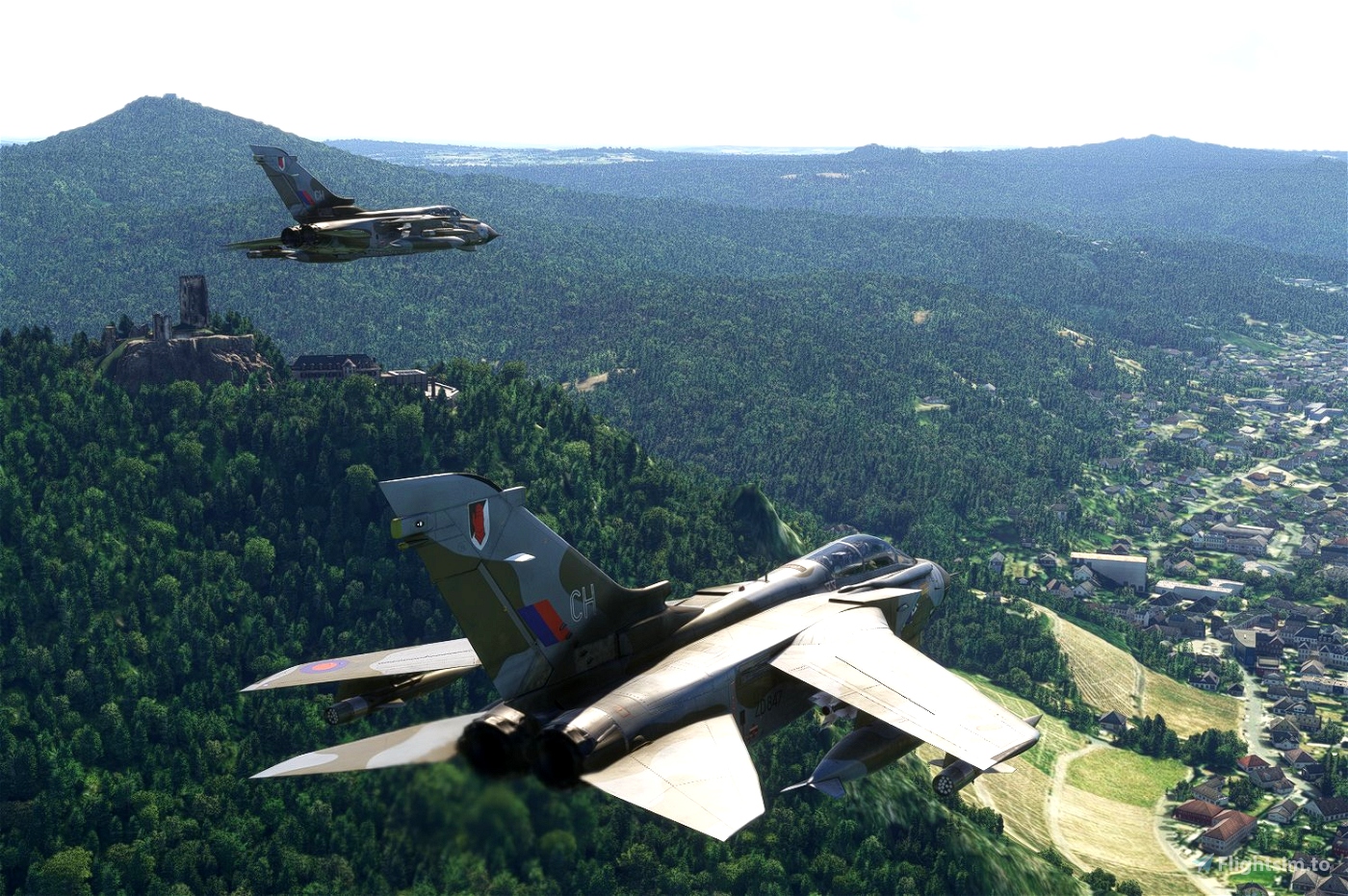
Look for the two castles at WP Delta and hook left into the hills heading for Echo. As the ground flattens out drop to 250 ft to enter the Low-Flying Area, it's OK to deviate from the plan to keep in the best valleys, just get to Echo, then head East.
At EderSee it's left again heading for and running alongside the Teutoberger Ridge then left again to visit RAF Guttersloh, watch out for helicopters!
You should be back to 500 ft now, but who's watching?
Now its North across the Ridge heading for Dummersee in the North German Plain, one of the best landmarks around it's often used by fast jets as a waypoint so keep a good lookout. Over the lake turn west heading for Rheine-Hopsten Air Base (last used by Luftwaffe Phantoms) and then on to Nordholn target range at WP Kilo. Your'e cleared for several passes...
When ready exit towards Twente airport at WP Lima, once used for Luftwaffe Starfighters, and then on for the last stretch home to Bruggen. This is a good segment to practice AAR if you're low on fuel.
Installation
Unpack the .PLN file anywhere you like really - you load a flight plan using the Load/Save dialogue in game and can navigate to your preferred location...or try a Load and see where the default location is for you, and put the .PLN file there.
Associated files
A good repaint for a Bruggen-based Tornado can be found here https://flightsim.to/file/73324/raf-tornado-gr1-14-sqn-zd846
No add-on scenery for RAF Bruggen yet but one is on its way.

 keithb77


14 days ago
manuel1987
Where exactly do I have to insert the flight plan so that it is then available in the game?
14 days ago
14 days ago
keithb77
manuel1987
i just had a go at this German run... How fun it was!!!
Do you intend to make the same for the Mach Loop?
Cheers,
Stéph.
15 days ago
14 days ago
keithb77
gribouil